From paper maps to digital realities, the evolution of 3D terrain modeling has revolutionized the way we view and interact with our world. Terrain modeling is the process of creating a digital representation of the Earth’s surface, allowing for detailed analysis and visualization of topography, terrain features, and landforms. Over the years, advancements in technology have transformed the way terrain models are created and used, from traditional paper maps to sophisticated digital tools that offer unparalleled accuracy and realism.
One of the major milestones in the evolution of 3D terrain modeling was the advent of Geographic Information Systems (GIS) in the 1960s. GIS allowed researchers and cartographers to create digital maps and terrain models by overlaying different layers of spatial data. This groundbreaking technology made it possible to analyze and visualize terrain features in a way that was not possible with traditional paper maps. GIS paved the way for the development of more advanced 3D terrain modeling techniques that are widely used today.
Another significant development in the field of 3D terrain modeling was the introduction of LiDAR (Light Detection and Ranging) technology in the 1970s. LiDAR uses laser pulses to measure distances to the Earth’s surface, creating highly accurate 3D models of terrain features. This technology has revolutionized the way terrain models are created, providing researchers with detailed and precise data that can be used for a wide range of applications, from urban planning to environmental monitoring.
The rise of satellite imagery and aerial photography has also played a crucial role in the evolution of 3D terrain modeling. High-resolution satellite images and aerial photographs can be used to create detailed terrain models that capture the Earth’s surface with stunning realism. These images can be combined with LiDAR data and other spatial information to create highly accurate and realistic 3D renderings of the Earth’s terrain.
Advancements in computer technology have also played a key role in the evolution of 3D terrain modeling. The increasing power and capabilities of computers have made it possible to process and analyze vast amounts of spatial data, allowing for the creation of complex and detailed terrain models. Today, sophisticated software tools are available that allow researchers and cartographers to create highly detailed and realistic 3D terrain models with ease.
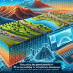
The evolution of 3D terrain modeling has had a profound impact on a wide range of industries, from urban planning and environmental management to video game development and virtual reality applications. Terrain models are used to analyze and visualize terrain features, assess potential risks and vulnerabilities, and plan infrastructure projects. In the gaming industry, 3D terrain models are used to create immersive and realistic virtual worlds that offer players a truly interactive experience.
As technology continues to advance, the possibilities for 3D terrain modeling are endless. From creating detailed simulations of natural disasters to designing virtual worlds for entertainment and education, the evolution of 3D terrain modeling has opened up new possibilities for how we interact with and understand our world. By harnessing the power of digital tools and technologies, researchers and cartographers can continue to push the boundaries of what is possible in terrain modeling, creating highly detailed and realistic representations of the Earth’s terrain for a wide range of applications.